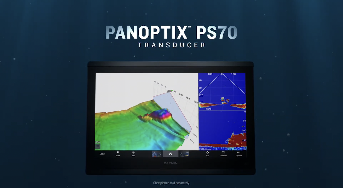
Panoptix PS70 Sonar Modes
The PS70 offers four sonar modes, each suited to different offshore fishing applications.
LiveVü Down Mode
LiveVü Down provides real-time live sonar images directly beneath the hull to depths of 1,000 feet. You see baitfish, target fish, and structure as they actually move — updated fast enough to watch fish respond to a bait in real time. For captains working deep water canyons, wrecks, and offshore structure, LiveVü Down changes how you position the boat and work a spread.
Traditional Sonar
The PS70 includes standard CHIRP traditional sonar for captains who want conventional sonar returns alongside the live sonar capability. Clean bottom definition, fish arches, and bait school identification in a familiar display format.
Triple-Beam Traditional Sonar
Triple-beam produces a three-way traditional sonar split — sonar returns from the port direction, starboard direction, and directly beneath the hull — displayed simultaneously in a single easy-to-read view. For captains covering water and marking structure, triple-beam gives broader lateral coverage than a single-beam traditional sonar without requiring a separate transducer.
RealVü 3D Historical Scanning
RealVü 3D historical scanning technology builds a three-dimensional map of the water column and ocean floor beneath the vessel as it moves. The full water column from surface to bottom — including fish — is rendered in 3D, and the True Motion feature follows the vessel's course over the ground for accurate spatial reference. For surveying new bottom structure or building detailed charts of productive offshore areas, RealVü 3D covers wide swaths of the ocean floor at depths up to 1,000 feet.
QuickDraw Contours Integration
The PS70 integrates with Garmin's QuickDraw Contours feature, allowing captains to survey and chart ocean floor detail at depths up to 1,000 feet in real time. Areas surveyed with the PS70 are stored directly on the connected GPSMAP chartplotter, building a proprietary bottom chart of productive offshore structure that stays on the vessel and isn't shared with other users.
For captains who invest time finding productive offshore bottom, QuickDraw Contours turns that knowledge into a permanent, accurate chart.
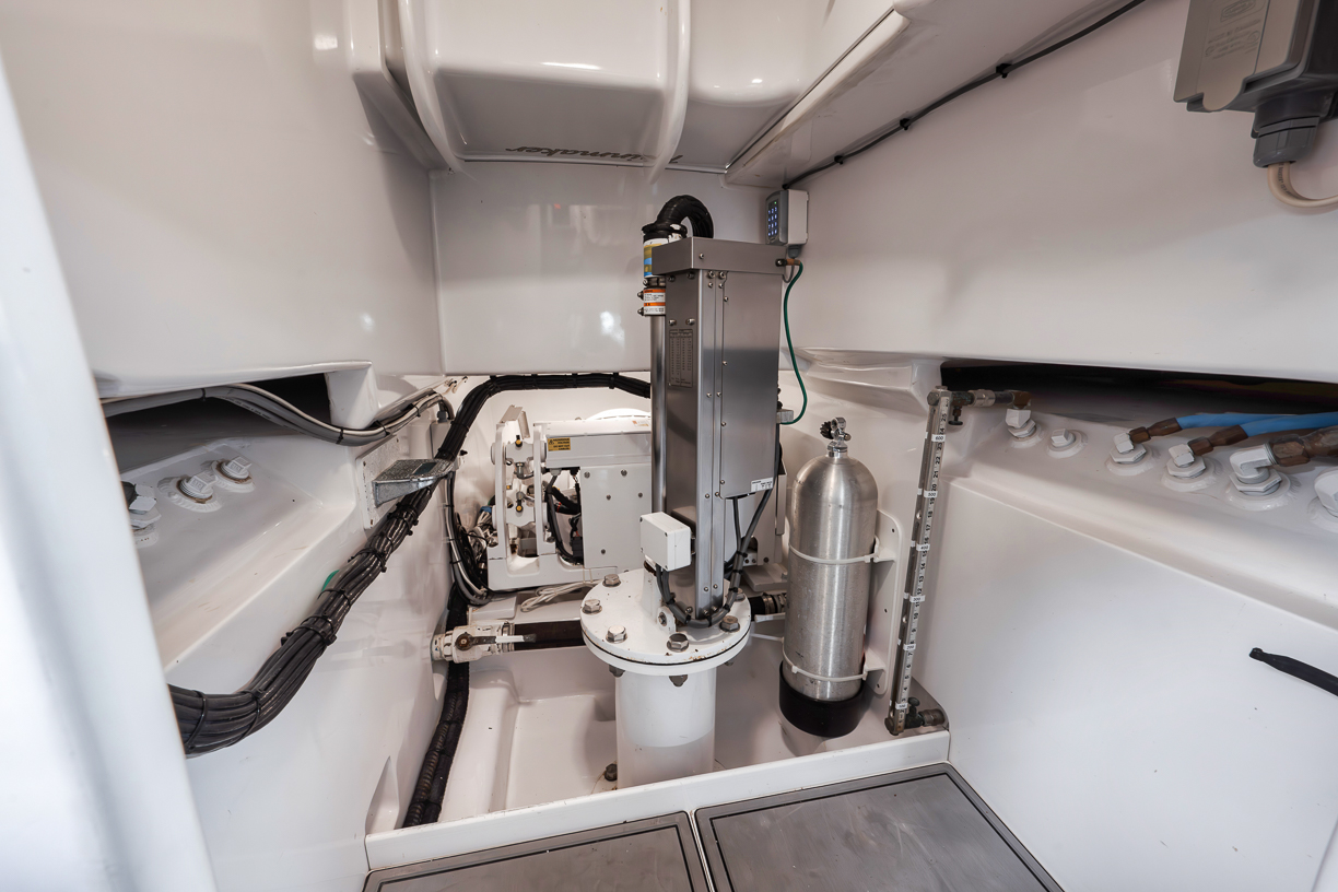
Panoptix PS70 Installation: What It Takes
The PS70 is a thru-hull transducer, which means installation involves boring a hull penetration, fitting the transducer tube at the correct angle for the vessel's deadrise, and finishing the bilge-side installation cleanly. The fairing block accommodates hull deadrise angles from 0 to 20 degrees, with flush pocket mounting also available depending on hull geometry.
Transducer angle affects sonar beam geometry directly. The PS70's 120-degree by 8-degree beam is optimized for a specific orientation — get the installation angle wrong and the beam coverage shifts away from what Garmin engineered. We set the angle based on each vessel's hull form and the captain's primary fishing application before the boat leaves the dock.
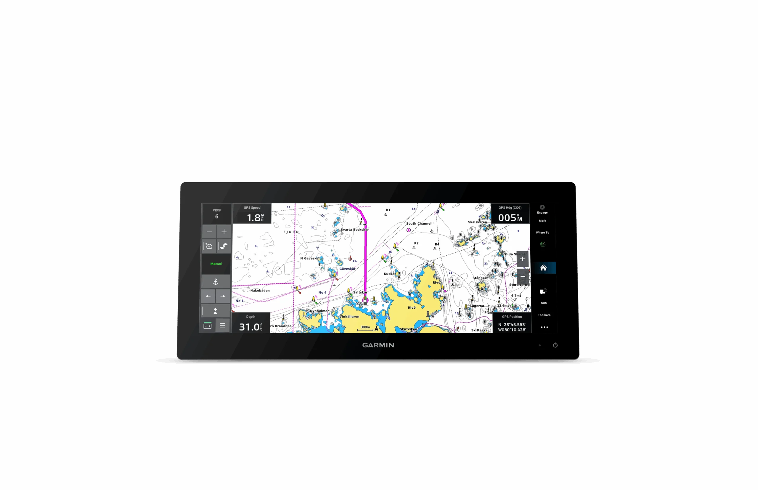
Cable routing from the transducer to the connected GPSMAP chartplotter affects signal integrity. The PS70 connects directly to compatible GPSMAP units — including the GPSMAP 8000 and 9000 series — over the Garmin Marine Network, and sonar data displays directly on the helm chartplotter. On vessels with multiple networked displays, the RapidReturn sonar image can be split across displays while maintaining chart, radar, and instrument data simultaneously.
Every PS70 installation we complete includes hull placement assessment, transducer installation and finishing, network integration with existing GPSMAP chartplotters, and on-water verification of sonar performance before sign-off.
Panoptix PS70 Installation in Jupiter, FL and Southeast Florida
O-Sea-D Marine Electronics installs and configures the Garmin Panoptix PS70 for sportfish vessels and motor yachts based in Jupiter, FL and throughout South Florida to the Treasure Coast and beyond. Request a quote here or call 561-339-9561.
Explore our full Garmin installation services →